
Paris Undaground 2007 / Exploring with Interactive Urban Cartography
“Paris Undaground 2007” is an experimental research project developed in 2007 during my fourth year at art school. It was created as part of a broader investigation into the concept of the labyrinth and the idea that a city can be understood through its plans, signs and hidden infrastructures. Long before digital mapping became part of everyday life, I wanted to imagine an interactive interface capable of revealing the invisible layers beneath the streets of Paris.
For as long as I can remember, I have been fascinated by underground spaces. Beneath Paris lies another city that remains almost entirely invisible to those walking above it. Every street conceals an extraordinary network of tunnels, quarries, sewers, technical galleries, transport infrastructures and forgotten passages. These underground worlds have accumulated over centuries, each generation adding new layers until they formed an immense labyrinth hidden beneath the capital.
Although invisible, these networks are deeply connected to the history of Paris. They record the city’s continuous transformation through engineering, construction, excavation and urban expansion. Looking beneath the surface reveals not only technical infrastructures but also another way of understanding how cities evolve over time.
At the time this project was conceived, online mapping technologies were still in their infancy. Services such as Google Maps and Google Street View had not yet become the universal navigation tools we know today. My intention was therefore not simply to produce maps, but to imagine a completely new interface allowing users to navigate through underground space in an intuitive and visual way.
Rather than presenting technical documents, Paris Undaground proposed a new reading of the city.
The project took the form of an online navigation interface where users could move freely between two complementary representations: the traditional plan view and sectional cross-sections revealing the different underground layers. Switching continuously between these perspectives allowed visitors to better understand how independent networks coexist beneath the same streets.
The underground of Paris is composed of multiple systems built over different historical periods. Sewers intersect with former quarries, technical galleries run alongside transport infrastructures, while older constructions remain buried beneath more recent developments. These layers do not simply overlap; they create a highly organised complexity that resembles an enormous three-dimensional labyrinth.
The objective of Paris Undaground was therefore not only to display information but also to organise knowledge. The interface attempted to create a coherent method for exploring spaces that are normally fragmented across technical archives, engineering plans and historical documents.
This interest in hidden urban systems directly reflects the broader themes developed throughout my artistic practice. Rather than focusing solely on what cities display, I have always been interested in what they conceal. Hidden infrastructures, abandoned factories, disappearing graffiti and forgotten architectural fragments all reveal another reading of urban space beyond its visible appearance.
The project also questions the relationship between mapping and imagination. A map is often perceived as a neutral technical object, yet every map tells a story through the information it chooses to reveal. By visualising underground Paris, Paris Undaground transforms invisible engineering networks into an accessible narrative landscape that can be mentally explored.
This work also introduced ideas that would later reappear in many of my artistic projects. The concepts of urban layering, invisible structures, cartographic reading and hidden territories gradually became recurring themes within my research on cities and public space.
Several years later, these reflections naturally evolved into 48Nord2Est, an in situ street intervention created directly within the urban environment. Whereas Paris Undaground explored underground Paris through an interactive digital interface, 48Nord2Est translated that research into public space by reproducing the actual map of underground galleries on a Paris manhole cover using adhesive tape.
Together, the two projects form complementary approaches to the same question. One uses digital navigation to explore hidden infrastructures, while the other brings those invisible networks back onto the surface of the city itself.
Looking back today, Paris Undaground appears as one of the earliest projects establishing the conceptual foundations of my later work. It already combines several ideas that continue to shape my artistic practice: cartography, urban semiotics, labyrinths, invisible architecture and the relationship between visible and hidden cities.
Although originally conceived as a student research project, its questions remain remarkably relevant. Contemporary cities continue to develop through increasingly complex infrastructures that most inhabitants rarely perceive. By revealing these hidden systems, Paris Undaground invites us to reconsider the city not simply as a collection of buildings and streets, but as a layered organism whose most fascinating structures often remain buried beneath our feet.
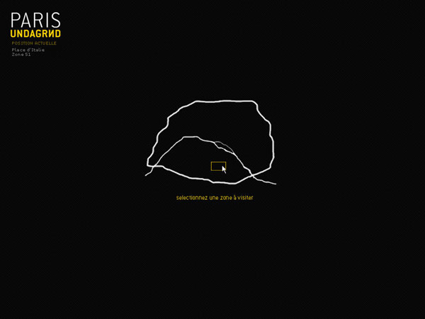
The first step is to choose the area of Paris where we wish to travel.
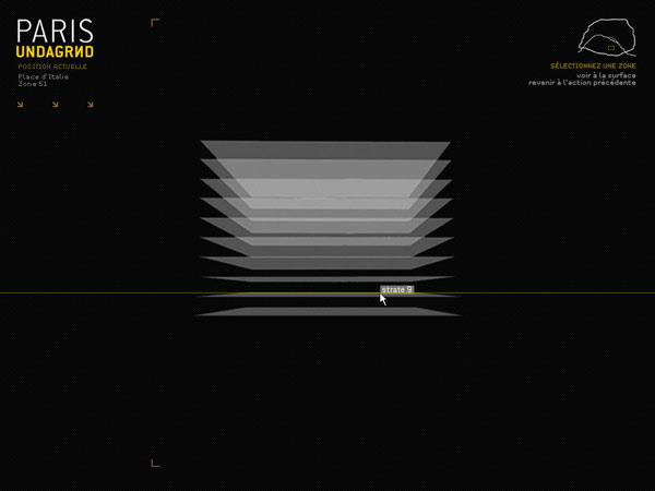
We will then be able to navigate between the cross-section and the plan view to visualize various routes. Each area of Paris will be broken down into ten strata that make up the cross-section. These ten strata represent a depth of 3.5 meters underground, with the deepest subterranean levels reaching down to 35 meters beneath the capital. Some areas will not extend to such depths, as their underground structures do not go that deep.
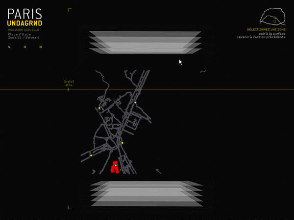
The selected cut becomes a map
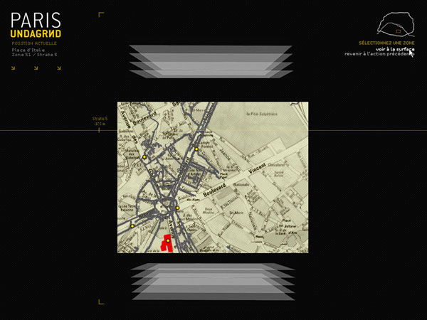
The floor map can be displayed at any time, each yellow dot is a clickable area.
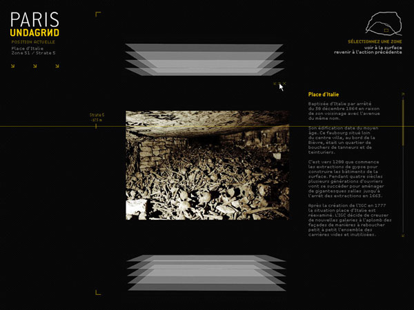
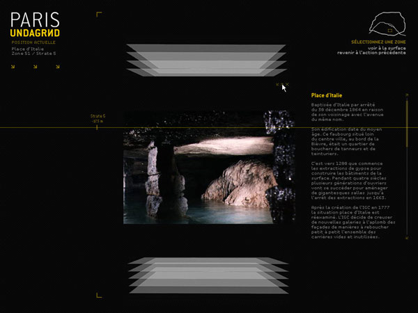
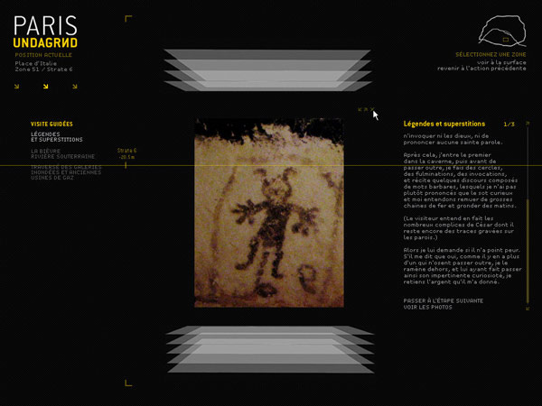
The yellow dots contain photo galleries and a description specific to the location.
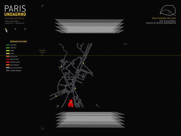
We can group the networks into the following categories: cellars, metro lines, RER lines, gas lines, sewers, crypts, parking garages, bunkers, main collectors, and quarries. Thus, P.U. allows you to focus on a single network or display them all
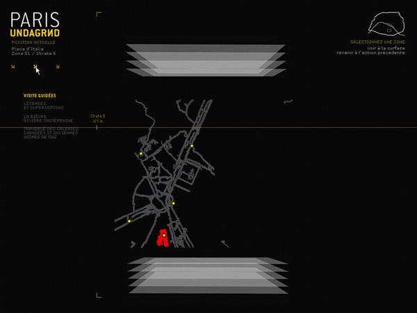
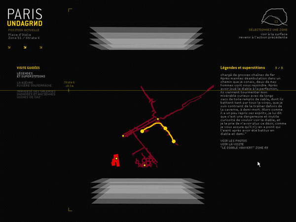
For users overwhelmed by the navigation options (or eager for historical knowledge), Paris UndaGround offers a guided tour system
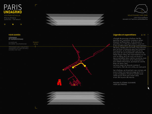
Over the centuries, various events have unfolded in the depths. Guided tours therefore offer a journey, starting from the surface or otherwise, that traces these events from beginning to end (for example: Jean Valjean’s escape with Marius on his shoulders as described by Alexandre Dumas, the visit by Napoleon III and his son, the story of Philibert, found dead after wandering for five years; the Resistance network, the refuge for the Communards; and so on).
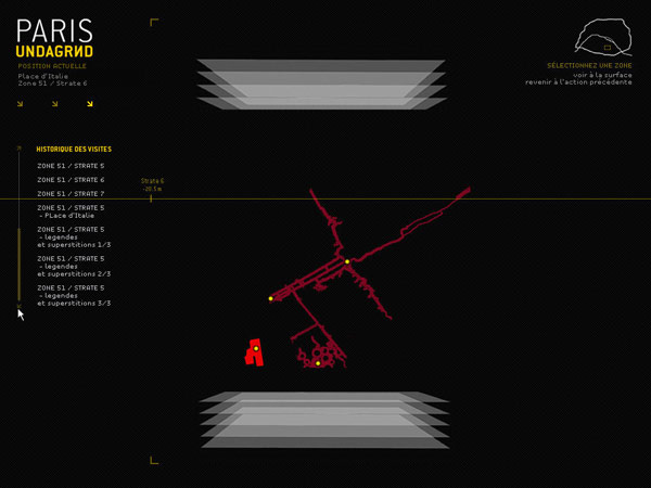
A history of recent visits is also provided, allowing users to revisit locations they have previously explored. The project’s primary aim is to make a “forgotten” Paris, where traces of various centuries abound and sit side by side, more accessible. It is a way of revealing elements that Parisians encounter every day without even noticing them
Frequently Asked Questions
What is Paris Undaground?
It is an experimental interactive project created in 2007 to explore the underground networks of Paris through digital cartography.
Why did you create this project?
It was developed during my fourth year at art school as part of research into labyrinths, urban signs and alternative ways of reading the city.
How did the interface work?
Users could navigate between plan views and cross-sectional views to discover the multiple underground layers hidden beneath Paris.
How is Paris Undaground connected to 48Nord2Est?
48Nord2Est extends the same research into public space by revealing the underground map directly on a Paris manhole cover through an urban intervention.
What themes introduced in Paris Undaground continue in your later work?
The project established recurring themes including cartography, urban semiotics, hidden infrastructures, invisible cities, labyrinths and the multiple layers that shape urban environments.